
BATHYMETRY SURVEY
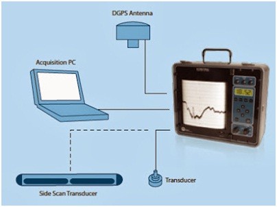
The bathymetry survey is intended to derive depth and topographic configuration / topographic data, including the location and extent of potentially harmful objects.
The bathymetry survey is intended to derive depth and topographic configuration / topographic data, including the location and extent of potentially harmful objects.